
When I first encountered the René Stevens’ maps from the first quarter of the 20th century, I wondered if some of the historical details depicted were actually true. Names of trees, geographical features. I was a chronological snob, ready to dismiss features as I did on maps showing people with faces in their chests or sea serpents.
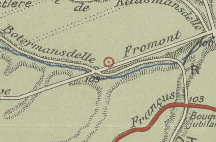
Among the features liberally scattered through the Forest are ‘Anciens établissements sidérurgiques’, or small scale former ironworks. Iron had been produced in the Forest for centuries, certainly up to the 16th century. Limonite, an iron ore, was mine, smelted and refined on the spot to obtain soft, malleable iron. The necessary charcoal was at hand and water too. So I compared a section of his 1917 map (see the red rondel) with the same section of a Digital Elevation Model of Flanders II, multidirectional hillshade layer from Geopunt.
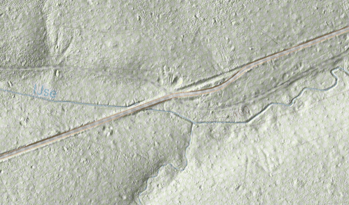
I could mention lots of things which are the same, and which are different, like the course of the Ijse, which rises near here. You can have a go yourself. What I am talking about in particular is the small circular depression looking like a little moon crater just by the junction of Botermansdelle and Drève Fromont. That can be interpreted as a former charcoal pit.
I’ve learned to trust Stevens and his maps.